
Find of the Month
April 2025
Oaks Estate:
Where the Molonglo and Queanbeyan Rivers meet
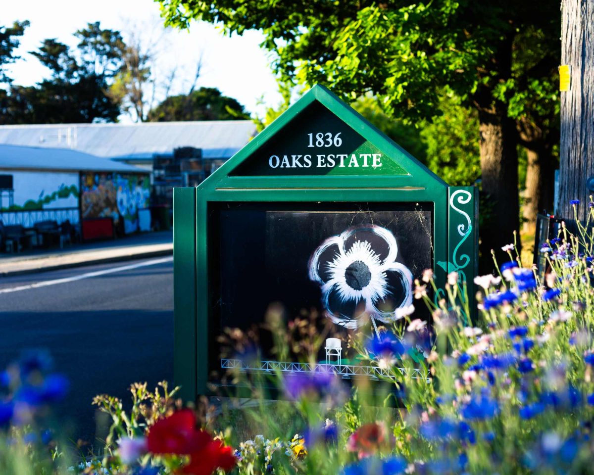
Fig. 1. Oaks Estate
Most Canberrans have probably never visited Oaks Estate. Many think it is part of New South Wales because it is so close to Queanbeyan, located right on the border between NSW and the ACT. Oaks Estate is an urban village, just 12km from the centre of the city and spanning around 40 hectares. It takes its name from an outstation of Duntroon established on the site in 1835 called ‘The Oaks’i. Notably, it is where the Molonglo and the Queanbeyan rivers meet, with the Molonglo forming its northern boundary. The Queanbeyan-Cooma railway lies to the south.
ArchivesACT holds various records that shed light on the history of the Oaks Estate. Territory lease files contain information about each block of land in the ACT, sometimes including aerial photographs. Other records such as development applications, planning files, and records relating to community development, roads management, environment protection, land use planning, and stormwater maintenance, can all help to tell the story of Canberra, and of Oaks Estate.
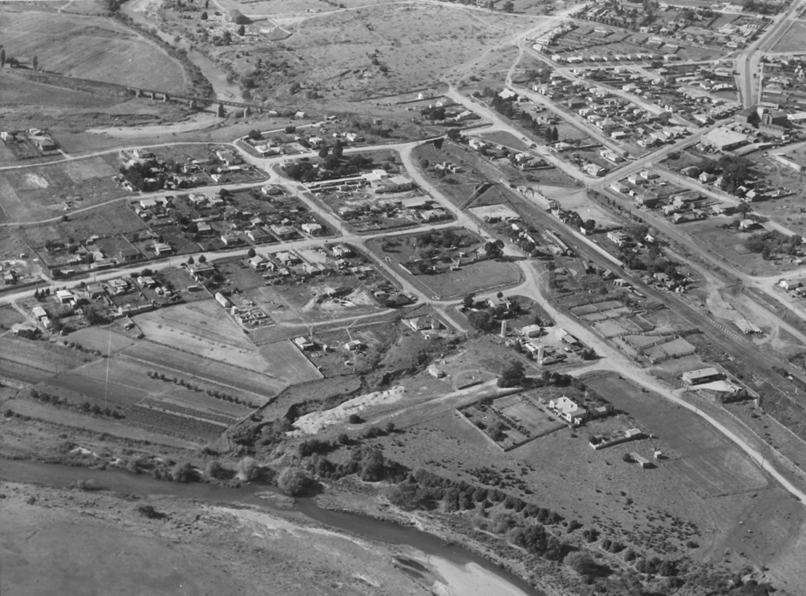
Fig. 2. Office of the Surveyor-General aerial photograph of Oaks Estate, 1951 to 1953
When the Federal Capital Territory's location was decided in 1908, the initial proposal included Queanbeyan and Captains Flat. However, the final decision incorporated the Gudgenby, Naas, and Paddy’s River catchments instead. This led to the border being drawn along the Queanbeyan railway line. Consequently, 40 hectares, including the northern blocks of the Oaks Estate subdivision and The Oaks house, became part of the Territory. Meanwhile, the railway line and the southern blocks, approximately 15 hectares, remained in NSW and were incorporated into Queanbeyan.ii
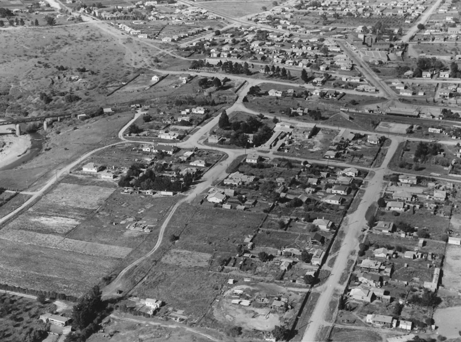
Fig. 3. Office of the Surveyor-General aerial photograph of Oaks Estate, 1951 to 1953
The debate over whether Oaks Estate should belong to NSW or the Territory persisted for many years. In the 1920s and 1930s, Charles Daley, Secretary of the Federal Capital Commission (NCDC) and later Civic Administrator for the Federal Capital Territory, was not a fan of the village. He initially pushed for the acquisition and demolition of all properties in Oaks Estate, and later advocated for its removal from the ACT. In the late 1930s and into the 1940s, members of the ACT Advisory Council, including Dr Lewis Nott, called for government attention to the poor service provision, referring to Oaks Estate as ‘The Cinderella of the Territory.’iii Minister for the Interior John McEwen supported connecting Oaks Estate to a better water supply. This decision was commemorated by naming the street where the village’s water tank stands as McEwan Avenue, although the records do not explain the difference in spelling of the Minister’s name.iv
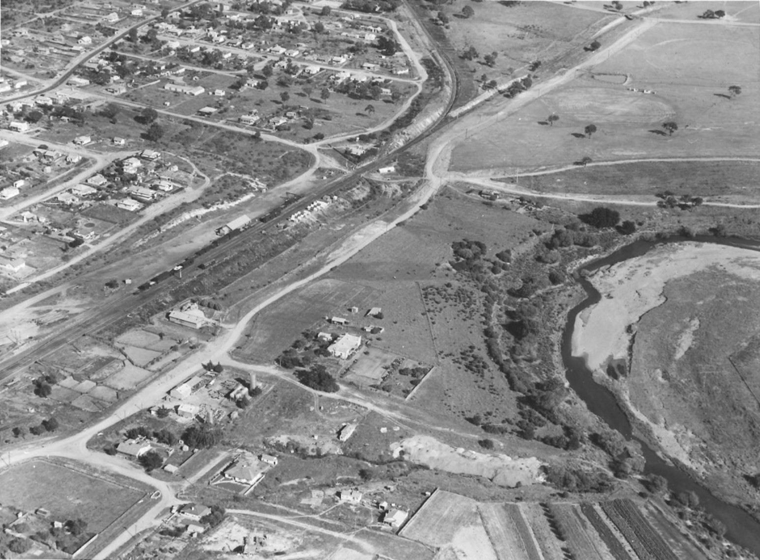
Fig. 4. Office of the Surveyor-General aerial photograph of Oaks Estate, 1951 to 1953
In 1950, after inspecting the site, members of the Advisory Council revisited the idea of reincorporation with Queanbeyan. Charles Daley reiterated his stance, calling Oaks Estate a ‘continual and increasing embarrassment.’v Little progress was made, and a 1962 study by the NCDC concluded that Oaks Estate’s low housing density made the expense of providing city services too high to be justifiable, while an alternative approach of increasing housing density would ruin its rural character and increase land rents.vi
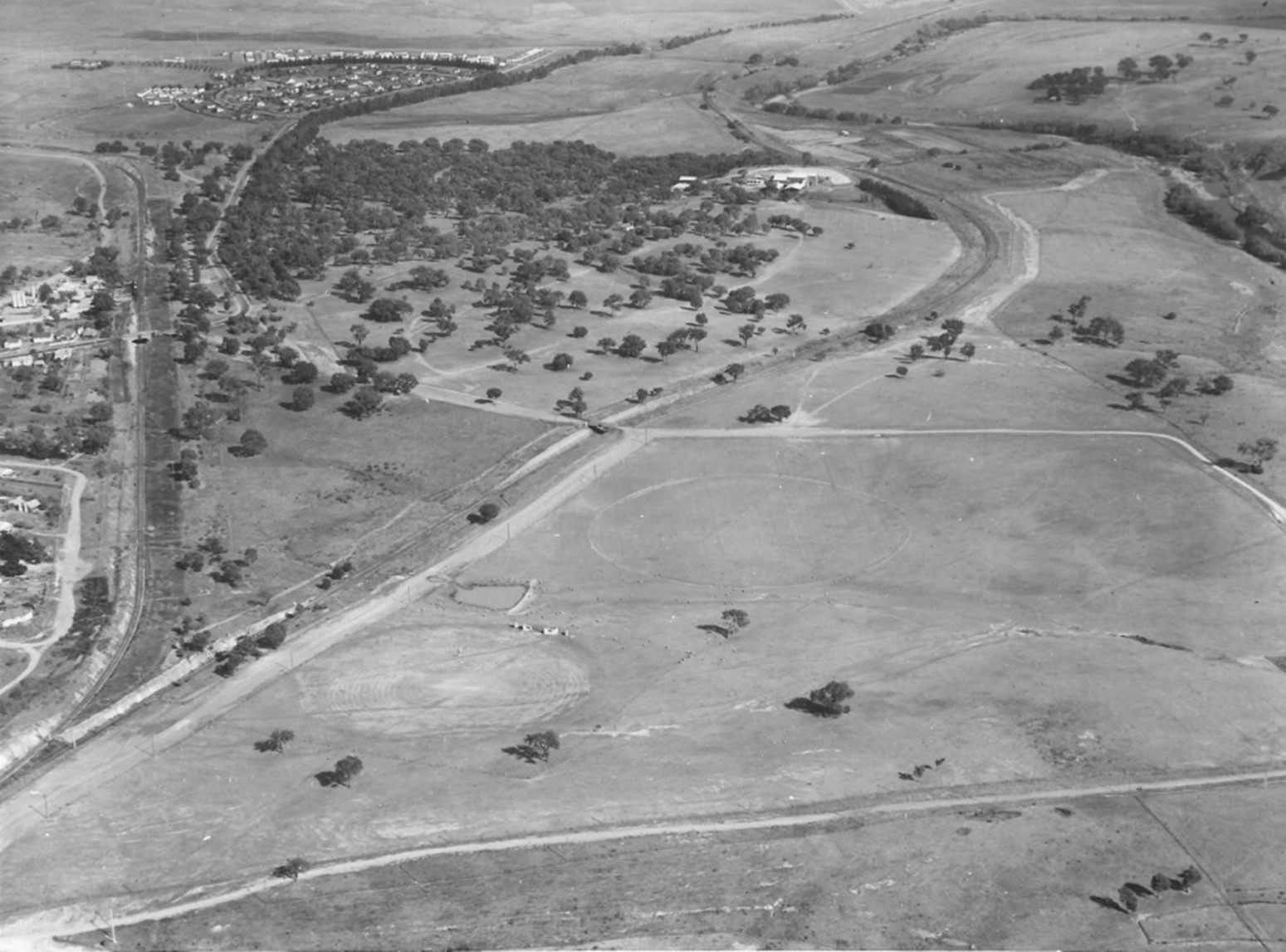
Fig. 5. Office of the Surveyor-General aerial photograph of Oaks Estate, 1951 to 1953
Oaks Burial Ground
Part of that rural character comes from the site of The Oaks Burial Ground, which holds historical significance as Queanbeyan’s first burial site. The earliest recorded burial occurred in a paddock near The Oaks homestead, although no headstones mark the graves. This site was used from 1838 until 1846, when the Queanbeyan Riverside Cemetery was established. Notably, one burial took place after this period, that of an unknown Indian juggler on April 8, 1863.vii Over time, the exact location of the burial ground had been forgotten, but in 1991 a backhoe operator unearthed skeletal remains while digging a storm-water trench in Florence Street. An anthropologist from the Australian National University (ANU) confirmed the bones were approximately 150 years old, identifying the site as The Oaks Burial Ground. Cemetery records of Oaks Burial Ground can be found on Interment.net.
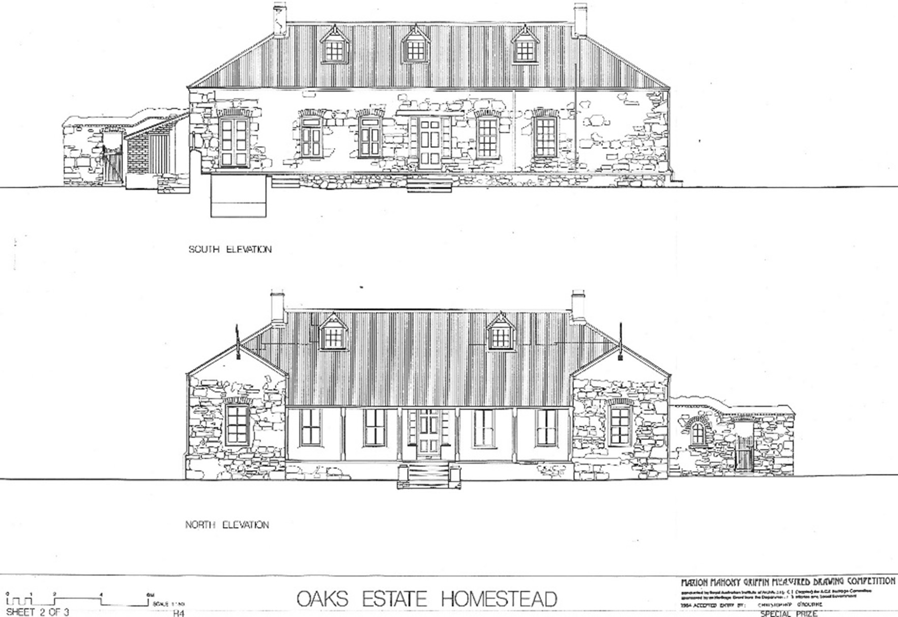
Fig. 6. The Oaks Estate Homestead – Oaks Estate Section 2 Block 16 & 19
The Oaks Estate Homestead
The Oaks Estate Homestead has a history spanning over 170 years. During this time, it has had several uses, including as the first inn in the area, the first hospital, and later hosting the 11th Garrison Battalion during World War II. The homestead was constructed around 1837 by Robert Campbell for members of his family who were expected to migrate to Australia. When the family members did not in the end arrive, the property was leased to William Hunt and Joseph Kaye, who used the homestead to open the region's first inn, making it an important site for local social life. In 1848, Dr Hayley leased the property, and it became the region’s first hospital. The building, constructed from roughly worked local stone, was of high quality, making it robust enough to survive its many various uses and still stand today. The property size was originally 1,040 acres, but in 1888 it was reduced to 5 acres. It is now a private residence.
Of course, the history of the land around Oaks Estate did not begin with the Duntroon outpost. The area was a gathering point where tribal groups from the lower Lachlan and Murrumbidgee rivers and neighbouring regions gathered to feast on bogong moths. A significant pathway follows the Molonglo River and includes a camping ground and meeting place at its junction with the Queanbeyan River. An account in the Queanbeyan Age in 1862 talks, in terribly racist terms, about Aboriginal people from Braidwood, Yass and the Bland Plains (north of Temora) gathering in the area, while pinpointing ‘the bank of the Queanbeyan River, opposite the Oaks, the residence of Dr Hayley’ as the site of an Aboriginal campground.viii
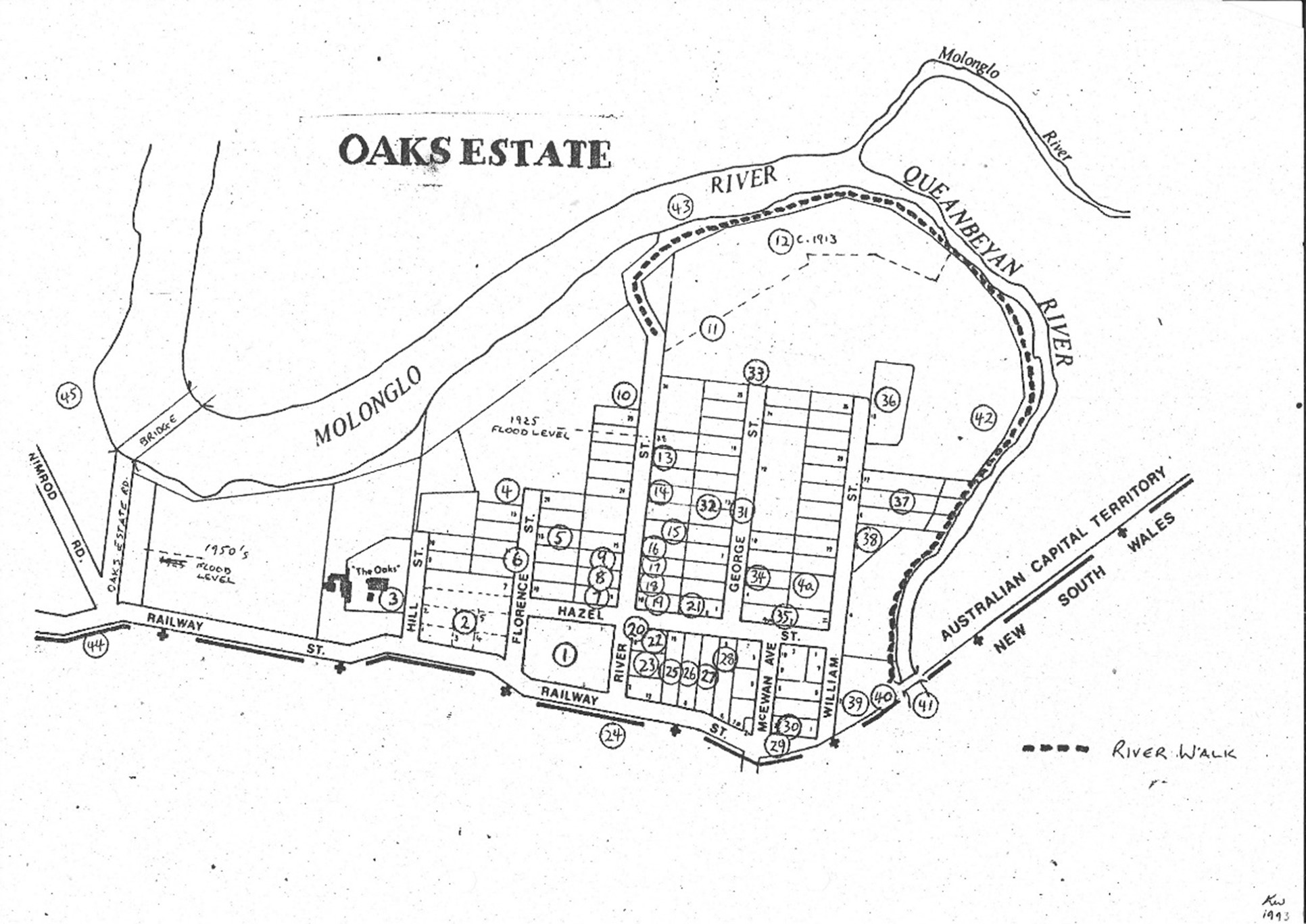
Fig. 7. Map of Oaks Estate – Section 7 Block 11 & 12 Railway & Hazel Streets – Robertson House
The river junction that helped make the spot such an important camping and gathering site for Aboriginal people also made it attractive to while settlers. Robert Campbell recognised the site where two rivers meet as an economic opportunity, providing access to water, shallow crossing points and, increasingly, access to road and rail connections leading back to the expanding colony.ix He could not have known, when he displaced the traditional owners in 1837, that similar arguments about borders, ownership and responsibility for the land would continue with the advent of Federation and the establishment of the Federal Capital Territory.
ACT Government files used
801/2/16&19: OAKS ESTATE, SECTION 2, BLOCK 16 & 19 - THE OAKS – Heritage Unit
801/7/11&12: OAKS ESTATE, SECTION 7, BLOCK 11 & 12, RAILWAY & HAZEL STREETS – Robertson House
2023/24988 ACT Development Record - Aerial Photography - 1951 to 1953 - Run 6 - Oaks Estate - O'Connor – Obliques 1 – 4
91/08469 – ACT Heritage Unit – Oaks Estate
Images
Fig. 1. Oaks Estate 1836 – 2CA website AM1053
Fig. 2. 2023/24988 - ACT Development Record – Aerial Photography – 1951 to 1953 – Oaks Estate 1
Fig. 3. 2023/24988 - ACT Development Record – Aerial Photography – 1951 to 1953 – Oaks Estate 2
Fig. 4. 2023/24988 - ACT Development Record – Aerial Photography – 1951 to 1953 – Oaks Estate 3
Fig. 5. 2023/24988 - ACT Development Record – Aerial Photography – 1951 to 1953 – Oaks Estate 4
Fig. 6. Oaks Estate Homestead from file – 801/2/16&19
Fig. 7. Map of Oaks Estate from file – 801/2/16&19
References
i ACT Heritage Council. Background information: Oaks Estate Subdivision and Environs, part 1, p. 3. Oaks Estate Subdivision and Environs - Background information
ii ACT Heritage Council. Background information: Oaks Estate Subdivision and Environs, part 1, p.6. Oaks Estate Subdivision and Environs - Background information
iii Oaks Estate (1937, September 2). The Canberra Times, p. 5. Retrieved February 24, 2025, from http://nla.gov.au/nla.news-article2440382
iv ACT Heritage Council. Background information: Oaks Estate Subdivision and Environs, part 2, p. 40. https://www.environment.act.gov.au/__data/assets/pdf_file/0019/1050544/oaks-estate-subdivision-and-environs-background-information-part-2.pdf
v Council defers decision on Oak’s Estate (1950, March 28). The Canberra Times, p. 2. Retrieved January 27, 2025, from http://nla.gov.au/nla.news-article2772943
viACT Heritage Council. Background information: Oaks Estate Subdivision and Environs, part 1, p. 6.
vii Interment.net: Oaks Burial ground, https://www.interment.net/data/aus/act/oaks/
viii ACT Heritage Council. Background information: Oaks Estate Subdivision and Environs, part 1, p. 2.
ix ACT Heritage Council. Background information: Oaks Estate Subdivision and Environs, part 1, p. 3. Oaks Estate Subdivision and Environs - Background information
Ready to start your own research?
Contact us through our Request a record - ArchivesACT and we will be happy to help.
File Readers/Viewers
If you do not already have compatible software on your computer, free file readers/viewers can be downloaded from the following links.
 PDF files require Adobe Acrobat Reader
 PPS files require Microsoft PowerPoint Viewer
 XLS files require Microsoft Excel Viewer